<img src="https://ws.zoominfo.com/pixel/kZxG1sNctrruFoZSPoVD" width="1" height="1" style="display: none;">
Contact Us
Book A Demo
Menu
Book A Demo
Contact Us

Ventiv Geospatial

Leveraging Ventiv's GIS analytics solution, harness the hidden insights in your location data and predict risk outcomes to drive transformation

Talk to an Expert

https://www.ventivtech.com/hubfs/Products/Ventiv-Geospatial-Decision-Analytics-Hero.mp4

Who is using Ventiv

  • Seal County of Los Angeles
  • Indiana Public Employers Plan
  • Tribal First
  • Cox Enterprises
  • The Mosaic Company
  • Nestlé
  • Seal-State-of-Georgia-sm
  • Takeda
  • Saint-Gobain
  • Henkel
  • Stagecoach
  • Travelopia
  • Textron
  • Uniting Church in Australia
  • Logo-Imperial-Brands-sm
  • Decathalon
  • Schlumberger
  • HPIC
  • K&S Freighters
  • Marriott
geospatial-analytics-size-of-problem-bg

Size of the Problem

geospatial software

$125B insured losses from natural catastrophe globally in 2022

geospatial analysis software

$60B losses from Hurricane Ian, 2nd largest on record

geospatial analysis tools

285 catastrophe events worldwide in 2022

geospatial tools

46 consecutive years of rising land and sea temperatures

geospatial software

8M average acres burnt by wildfires annually in US

Enhance catastrophe response

Better risk making decisions

Lower claim costs

Improves underwriting decisions

Prioritize loss control activities

Reduce fraudulent claims

Ready to learn more?

Product Highlights

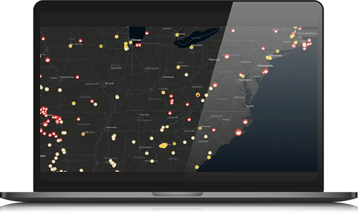
  •   Intuitive map-based visualization interface
  •   Real-time automated alerting
  •   Assess impact of geospatial events
  •   Seamless deployment
  •   Integration with Ventiv IRM solution
geospatial analysis tools, geospatial analytics
  • Find answers to difficult business questions

    Learn More
  • Ventiv Geospatial can answer questions such as:

    • What impact could a hurricane have on my properties in its current path?
    • How will rising sea levels & land temperatures affect my properties in low lying coastal areas?
    • What areas are most prone to civil unrest that could impact my retail properties?
    • Can I simulate a past natural disaster to identify low-risk areas to build my next nursing home? 


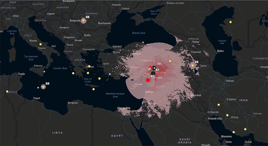
    Ventiv-Geospatial-Earthquake-screenshot

  • Deliver Advanced Warnings for Better Risk Outcomes

    Learn More
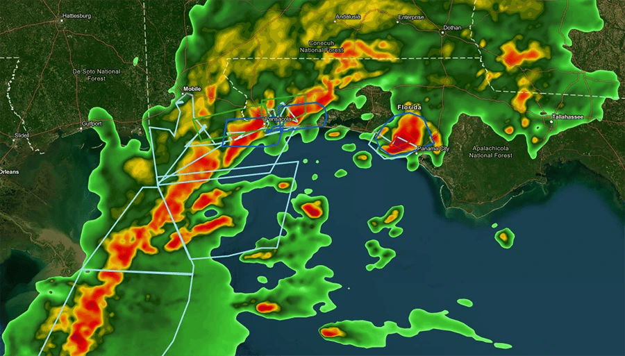
  • Provides real-time insights and alerts in the context of an easy-to-understand visual maps triangulated with property values, current or historical claims and developing real-time weather events allowing clients to prepare and mitigate impacts, and in some cases prevent material or human capital losses.


    Ventiv-Geospatial-Weather-Warnings-screenshot


  • Driver smarter and faster decisions

    Learn More
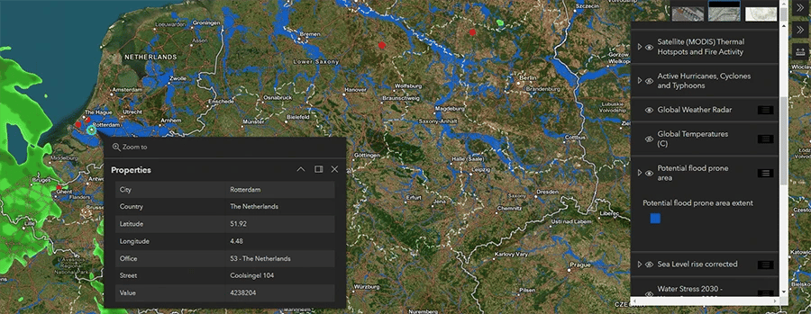
  • Seeing location-based data helps organizations understand why some locations are more risk-prone than others i.e., flood plains, high crime rate zones, tidal impacts, civil unrest etc.


    Ventiv-Geospatial-Flood-Risk-screenshot


  • Delivers Improved Risk Making Decisions

    Learn More
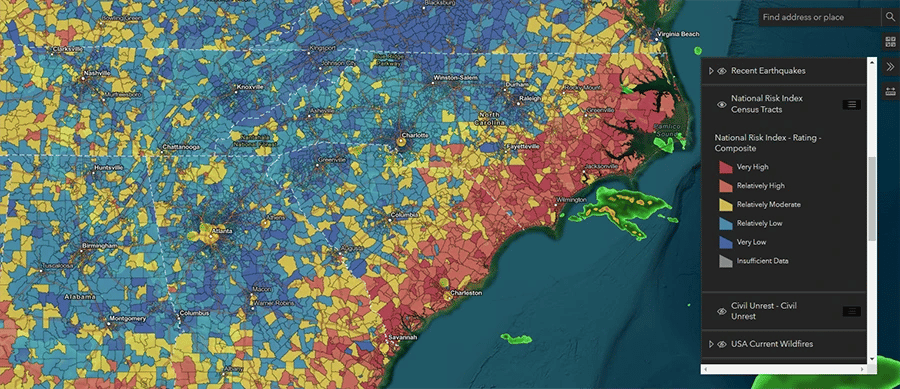
  • Geospatial allows for relationships and connections to be understood by factoring in the “what”, “where” or “when”. Organizations can use geospatial precision to improve risk management programs on recurring events.


    Ventiv-Geospatial-National-Risk-Rating-screenshot


Ventiv Geospatial can answer questions such as:

  • What impact could a hurricane have on my properties in its current path?
  • How will rising sea levels & land temperatures affect my properties in low lying coastal areas?
  • What areas are most prone to civil unrest that could impact my retail properties?
  • Can I simulate a past natural disaster to identify low-risk areas to build my next nursing home? 


Ventiv-Geospatial-Earthquake-screenshot

Provides real-time insights and alerts in the context of an easy-to-understand visual maps triangulated with property values, current or historical claims and developing real-time weather events allowing clients to prepare and mitigate impacts, and in some cases prevent material or human capital losses.


Ventiv-Geospatial-Weather-Warnings-screenshot


Seeing location-based data helps organizations understand why some locations are more risk-prone than others i.e., flood plains, high crime rate zones, tidal impacts, civil unrest etc.


Ventiv-Geospatial-Flood-Risk-screenshot


Geospatial allows for relationships and connections to be understood by factoring in the “what”, “where” or “when”. Organizations can use geospatial precision to improve risk management programs on recurring events.


Ventiv-Geospatial-National-Risk-Rating-screenshot


Want to talk?

You have questions about our Geospatial solution...we have answers!

Let’s talk about how we can move your business forward.

Download Solution Brief

Download our collateral for further details about how you can accurately visualize, assess and mitigate catastrophe and unexpected claims

Read Article

Ready or Not: Preparing for the Unexpected

Learn more about how GIS and AI are helping risk managers and insurers respond to catastrophe claims

Subscribe

Ventiv's 3SIXTYº Blog is the go-to source for risk, insurance, and safety managers. Subscribe and stay up to date.

Ready to move your business forward?

Let’s Talk

With 500+ global customers and counting, Ventiv is one of the premier leaders in the risk management, insurance claims and advanced analytics space. Helping some of the biggest brands on the planet with products like our industry leading geospatial solution.

Fill out the form, email us at contact@ventivtech.com or call one of our many worldwide office locations to get the conversation started today on moving your business forward.